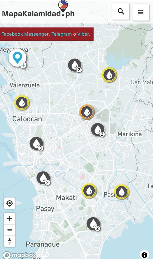
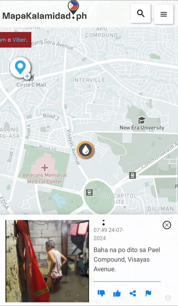
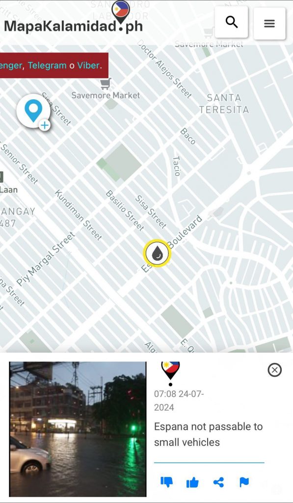
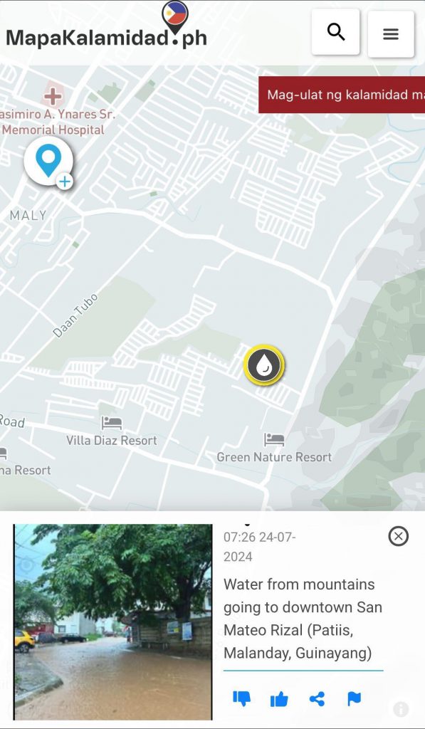
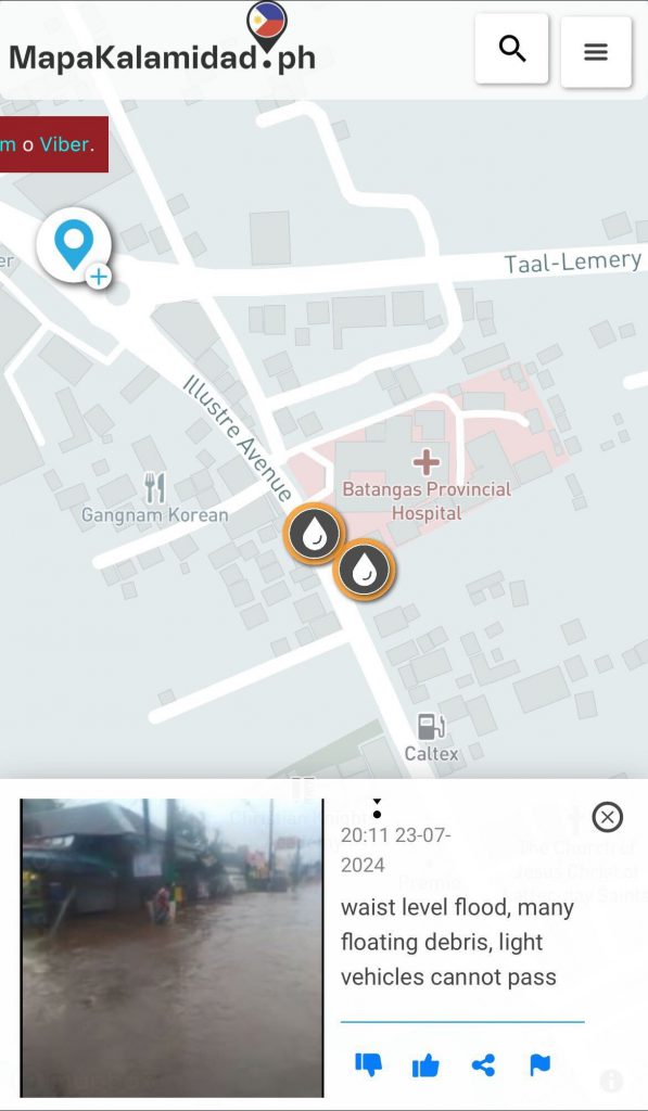
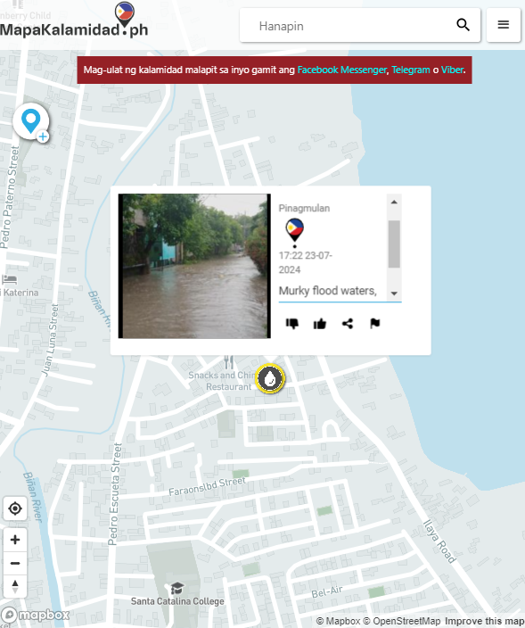
As super typhoon Carina (Gaemi) raged across the Philippines early this week, MapaKalamidad.ph has emerged as a vital tool in shaping disaster response efforts. This innovative platform, which allows citizens to report real-time incidents and hazards, has been instrumental in providing accurate, on-the-ground data to emergency response teams, local government units (LGUs), and the general public.
MapaKalamidad.ph has seen a significant surge in user reports during Carina’s onslaught. The platform enabled users to submit detailed reports about flooding, storm surges, strong winds, and power outages, and other critical incidents through a user-friendly interface. These reports are then visualized in a map and made accessible to authorities and the public, facilitating a more coordinated and efficient response allowing disaster response teams to quickly identify and prioritize areas in need of immediate assistance, ensuring that resources are deployed where they are most needed.
Moreover, MapaKalamidad.ph’s integration with social media has broadened its reach, encouraging more citizens to participate and share critical information. As a result, communities are not only better informed but also more engaged in the disaster response process, thereby saving lives and mitigating damage.
In addition to immediate disaster response, the data collected through MapaKalamidad.ph is proving valuable for long-term planning and resilience building. Using MapaKalamidad’s historical data, analysts will be able to identify patterns and vulnerabilities, informing infrastructure improvements and community preparedness programs.
As typhoons like this continue to challenge the resilience of the Filipino people, platforms like MapaKalamidad.ph highlight the importance of community involvement and technological innovation in disaster management.
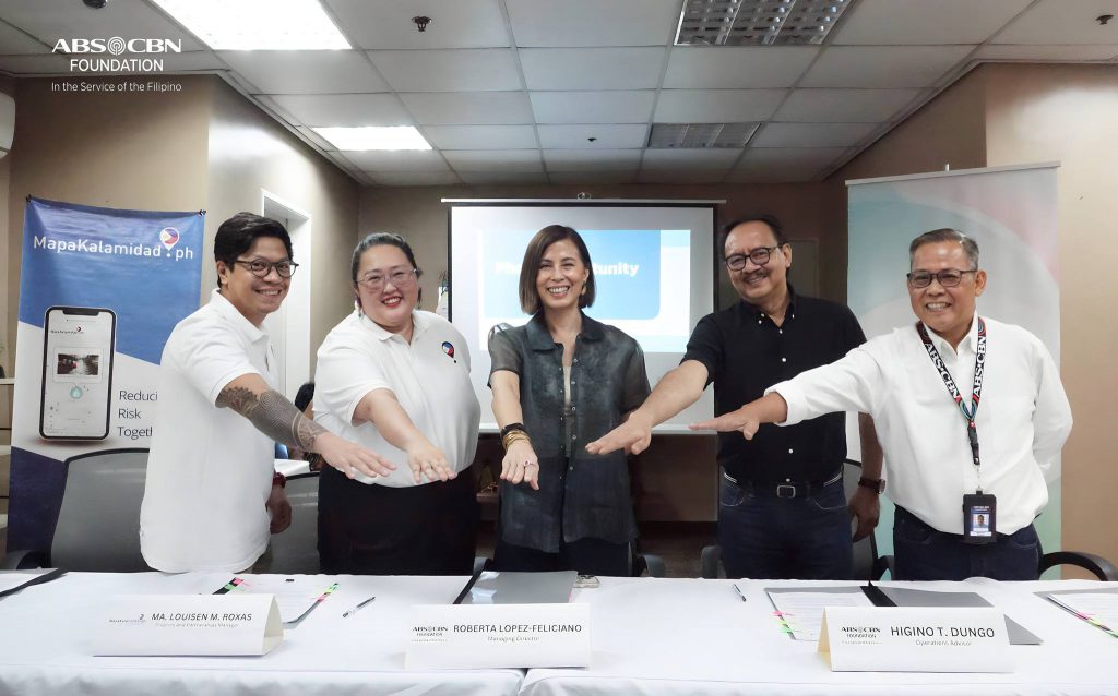
Quezon City, Philippines – In a significant move towards enhancing disaster response efforts across the Philippines, MapaKalamidad.ph has signed a Memorandum of Understanding (MOU) with the renowned ABS-CBN Foundation, Inc. (AFI) last June 5, 2024. The formal agreement marks the beginning of a collaborative partnership aimed at bolstering disaster preparedness, response, and recovery initiatives in the country.
The MOU signing ceremony, held at the ABS-CBN headquarters in Quezon City, brought together key representatives from both organizations, including AFI’s Managing Director, Roberta Lopez-Feliciano, Operations Advisor Jun Dungo, and Sagip Kapamilya Program Head, Marcel Riñon, and MapaKalamidad.ph Projects and Partnerships Manager, Ma. Louisen Roxas, and Geospatial Data Coordinator, Elton Pierre Evidente.
Through this strategic alliance, MapaKalamidad.ph will provide its mapping technology and data-driven solutions to support the ABS-CBN Foundation’s disaster response operations. By integrating real-time information and mapping capabilities, the partnership seeks to improve coordination, resource allocation, and timely assistance delivery in times of crisis, especially in hard-to-reach areas.
The signing of the MOU between MapaKalamidad.ph and the ABS-CBN Foundation signals a new era of cooperation in disaster management in the Philippines. As both organizations combine their strengths and resources, they are poised to make a meaningful difference in the lives of those affected by disasters, ultimately contributing to a more resilient and prepared nation.
Rappler, through MovePH, and MapaKalamidad have officially joined forces! Stay tuned for more updates as we work together to build stronger, more informed communities!
MapaKalamidad.ph is thrilled to enter into a partnership with De La Salle-College of Saint Benilde Center for Social Action. With this partnership, MapaKalamidad will empower Benildean community through disaster preparedness and community engagement.
The Memorandum of Agreement signing event on April 3, 2024 was attended by other institutional and barangay partners of the Center for Social Action. MapaKalamidad was represented by its project and partnerships manager, Ma Louisen Roxas.
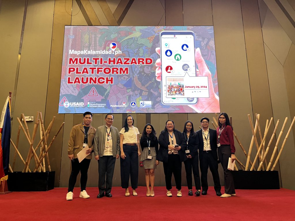
Manila, Philippines – January 29, 2024 – MapaKalamidad.ph, a groundbreaking platform designed to revolutionize disaster reporting in the Philippines, officially launched its multi-hazard platform on January 29, 2024, at Novotel Manila. This cutting-edge platform will enable individuals, communities, and authorities to report earthquake, typhoon, volcanic eruption, and flooding events, providing a comprehensive and real-time view of various hazards affecting the country.
The launch event was graced by the presence of distinguished representatives from the United States Agency for International Development (USAID), the Office of Civil Defense (OCD), the Canadian Embassy in the Philippines, and the Australian Volunteers Program underscoring the significance of this initiative in enhancing disaster preparedness and response efforts in the Philippines.
MapaKalamidad.ph is poised to play a pivotal role in transforming the way disasters are reported and managed in the country. By providing a unified platform for reporting multiple hazards, it will facilitate the timely dissemination of critical information, enhancing situational awareness and enabling swift response to emergencies. This will ultimately contribute to saving lives and minimizing the impact of disasters on communities across the Philippines.
The platform’s user-friendly interface allows individuals to report disaster events directly, providing essential data that can be utilized by authorities to coordinate response efforts effectively. Furthermore, the integration of advanced mapping technology enables the visualization of hazard-prone areas, empowering stakeholders to make informed decisions and implement targeted measures for disaster risk reduction.
“The scale of the challenges we face today cannot be addressed by one institution alone. It is imperative to enable every single resident, and every sector, to be able to participate in disaster risk reduction and recovery efforts, and that is our mission at MapaKalamidad.ph,” said Nashin Mahtani, director of Yayasan Peta Bencana [Disaster Map Foundation], and founder of the Climate Emergency Software Alliance. “By ensuring that everyone can safely, anonymously, and freely view and share real-time disaster information through their mobile phones, MapaKalamidad.ph empowers residents with the decision making tools they need to make critical decisions about navigation and safety. We believe in the power of technology repurposed to connect and empower individuals, fostering communities that collectively respond to and mitigate the impacts of the climate emergency.”
The launch of MapaKalamidad.ph marks a significant step forward in addressing the complex and evolving challenges posed by natural disasters in the Philippines. By harnessing the power of technology and bayanihan, this innovative platform is set to empower individuals, communities, and authorities to work together in building a safer and more resilient nation.
Development of the MapaKalamidad.ph platform is made possible with the support of the Bureau of Humanitarian Assistance of US Agency for International Development (USAID), with the Office of Civil Defense as a primary implementing partner and Mapbox and Humanitarian OpenStreetMap Team as data partners.
MapaKalamidad.ph, the leading disaster information sharing platform in the Philippines, entered into an official partnership with Philippine Transmarine Carrier Inc.’s (PTC) Resiliency Improvement, Support, and Education (RISE) for Seafarer Communities in the Philippines Program, the flagship disaster risk reduction and management program of PTC.
This strategic partnership aims to promote and enhance disaster preapredness efforts in the Philippines, particularly PTC RISE communities, through the use of MapaKalamidad.ph’s platform that harnesses the power of social media during disaster events to gather real time and on the ground updates straight from the residents. These verified user updates or reports are displayed alongside relevant emergency data collected by local and government agencies. By integrating localized knowledge from various sources into a single, robust platform, MapaKalamidad.ph provides a comprehensive overview of disaster events, enabling residents, humanitarian agencies, and government agencies to make more informed decisions during emergencies.
The Memorandum of Agreement signing ceremony took place on September 19, 2023, at First Maritime Place in Makati City. The event brought together key representatives from both organizations.
Through this partnership, MapaKalamidad.ph and PTC aim to achieve the following key objectives:
1. Strengthened Disaster Response: By combining the expertise of MapaKalamidad.ph and PTC, the partnership will enhance the efficiency and effectiveness of disaster response efforts, ensuring prompt and coordinated actions during emergencies.
2. Enhanced Data Integration: The collaboration will facilitate the integration of PTC’s maritime data and MapaKalamidad.ph‘s comprehensive disaster management platform, enabling seamless information sharing and improved decision-making processes.
3. Heightened Awareness and Preparedness: Together, the organizations will work to raise public awareness about disaster preparedness through joint initiatives, educational campaigns, and community outreach programs.
4. Training: The partnership will focus on training sessions, and workshops to equip stakeholders with the necessary skills and knowledge to respond effectively to disasters.
In a bid to shed light on the innovative approach to disaster resilience, MapaKalamidad.ph’s project manager appeared on CNN Newsroom Ngayon with Ruth Cabal for a live discussion about the groundbreaking disaster mapping platform, MapaKalamidad.ph.
The segment, aired on January 31, 2023 at 3:00 PM, featured Sen Roxas, the project and partnerships manager of MapaKalamidad.ph, as she delved into the development, functionality, and potential impact of the platform on disaster response and mitigation efforts in the Philippines.
MapaKalamidad.ph has been making waves with its proactive approach to disaster preparedness, leveraging geospatial data and community engagement to map disaster-prone areas, assess vulnerabilities, and facilitate effective response strategies. The platform’s potential to positively influence emergency management practices nationwide has garnered widespread attention.
During the interview, viewers were expected to gain a comprehensive understanding of how MapaKalamidad is revolutionizing disaster resilience in the Philippines and beyond. MapaKalamidad has been at the forefront of leveraging technology for the greater good, and this CNN appearance only further highlighted the platform’s role in shaping the future of disaster management in the country.
Yayasan Peta Bencana, supported by USAID BHA and endorsed by the Office of Civil Defense (OCD), conducted a nationwide disaster preparedness event with barangay community leaders from all over the Philippines!
Attended by more than a thousandbarangay community leaders, participants simulated real-time disaster information sharing via the MapaKalamidad.ph platform. MapaKalamidad.ph is a free and open-source platform that provides real-time disaster information and transparent communication between residents and government agencies, to reduce risk and increase emergency response times during the sudden onset of disasters. The online platform harnesses the use of social media to crowdsource disaster information from residents on the ground, who often have the most up-to-date information, and displays this information on a live web-based map.
An average of 20 typhoons per year enter the Philippine area of responsibility. In 2021, the country was struck by a total of 22 storms, 9 typhoons, and 5 super typhoons. The most recent one, Typhoon Odette, strengthened from category 1 to 5 in just one day making it difficult, if not impossible, for people to prepare. As the rapid intensification of storms becomes more common due to climate change, real-time information is increasingly becoming the most important resource to understand and respond to rapidly changing situations.
In the Philippines, millions of residents already actively share real-time updates through their social media networks. However, there is currently no central platform wherein these real-time posts or reports are being gathered, sorted, and geospatially related, for easy access and public viewing. This is the gap that MapaKalamidad.ph fills–the platform deploys AI-assisted “humanitarian chatbots” to automatically respond to disaster-related social media posts, and asks users to confirm their situation by submitting a disaster report. Verified reports are displayed on a data light, mobile-centric, web-based map that is available to all residents, disaster managers, and emergency responders to allow them to view and share real-time flood information and make timely decisions to reduce risk.
As a community-led disaster information sharing platform, MapaKalamidad.ph is developed through collaboration and sustained engagement with the widest variety of stakeholders. On Thursday, February 24th, MapaKalamidad.ph’s disaster preparedness event invited barangay leaders to participate in a live demonstration that exemplified how crowdsourced information collected via MapaKalamidad.ph could be leveraged to support response in their areas of responsibility. Barangay leaders participated in a “train the trainer” activity, aimed to equip participants to autonomously train their own organizations, community groups, or neighborhoods effectively and repeatedly as preparedness actions over time.
Disaster reports submitted to MapaKalamidad.ph are also pivotal to help emergency managers better understand and respond to on-the-ground situations. Data collected by MapaKalamidad.ph is automatically integrated into OCD’s PhilAWARE Disaster Monitoring platform. According to Joseph Curry, from USAID BHA, “In the true spirit of bayanihan, MapaKalamidad.ph gives us a tool that everyone can use together in disaster response, potentially connecting every barangay right to the top.”
In 2021, the Philippines was struck by a total of 22 storms, nine typhoons, and five super typhoons. The most recent, Typhoon Odette, strengthened from a Category 1 to 5 typhoon in just one day making it difficult for people to prepare for the arrival of the storm or to evacuate. As the rapid intensification of storms becomes more common due to climate change, real-time information is increasingly becoming the most important resource to understand and respond to rapidly changing situations.
MapaKalamidad.ph is a free and open-source platform that provides real-time disaster information and transparent communication between residents and government agencies, in order to reduce risk and increase emergency response times during the sudden onset of disasters. The online platform harnesses the use of social media to crowdsource disaster information from residents on the ground, who often have the most up-to-date information, and displays this information on a live web-based map.
The Philippines has some of the highest social media usage rates in the world, and during disasters, social media feeds are inundated with real-time updates by residents calling for help and posting information. However, there is currently no central platform where these posts or reports can be viewed and accessed collectively or spatially. This is the gap that MapaKalamidad.ph fills—by filtering through disaster-related social media posts in real-time, the platform deploys AI-assisted “humanitarian chatbots” to ask social media users to confirm their situation. Verified reports are displayed on a data light, mobile-centric, web-based map that is available to all residents, disaster managers, and emergency responders in order to allow them to view and share real-time flood information and make timely decisions to reduce risk.
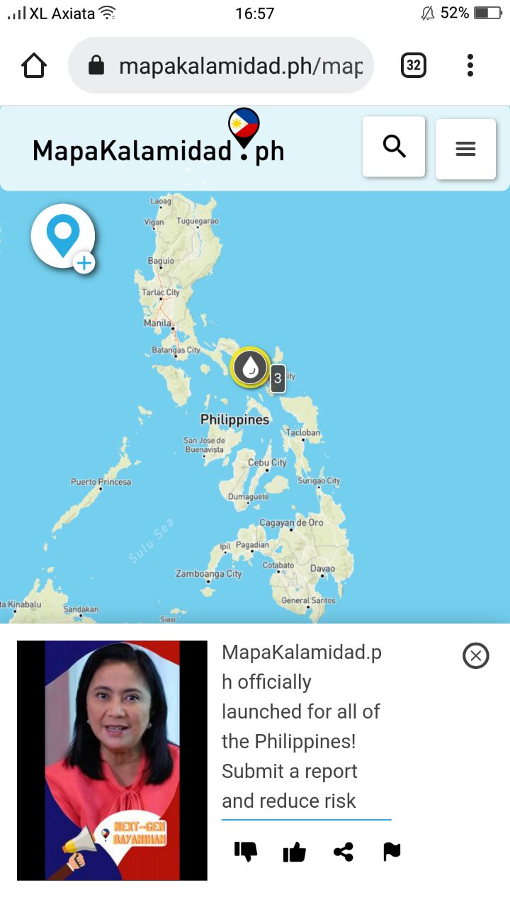
The official launch was opened by Madame Vice President Leni Robredo. In her opening remarks, she stated: “In imagining next-gen bayanihan, MapaKalamidad.ph harnesses not just the power of new tools and technologies, it is built on what is best in the Filipino. I urge everyone, especially youth, not just to share and use share [MapaKalamidad.ph] but to help lead your communities in reducing risk, building resilience, and fostering solidarity to face the ever-growing challenges of our changing climate.”
Madame Vice President Leni Robredo continued to highlight the urgent necessity to invest proactively in disaster preparedness, stating: “We have long been advocating for stronger disaster preparedness, with risk management plans anchored in our climate change realities, budgeting that prioritizes climate-resilient adaptation programs, and empowering systems that consult and engage affected communities at every step of the process. MapaKalamidad is a significant contribution in this endeavor.”
Madame Vice President Leni Robredo’s inaugural report on MapaKalamidad.ph marking the official launch of the national version of the flood mapping platform for the Philippines!
A pilot version of MapaKalamidad.ph was launched in 2020 for Quezon City and Pampanga, in collaboration with the Pacific Disaster Center (PDC) as part of the PhilAWARE project. The platform provides the fastest tool to collect, sort, and visualize real-time disaster updates in order to support response. During Typhoon Ulysess in November 2020, the platform experienced a significant increase in activity as residents in the pilot areas actively shared real-time situational updates about the flood. MapaKalamidad.ph was used to support residents and disaster management units to identify the areas that needed immediate response and rescue efforts. Following the uptake of the platform in the pilot areas, Yayasan Peta Bencana, together with USAID BHA and OCD officially launched the national version of the platform on January 14, 2022.
Nashin Mahtani, Director of Yayasan Peta Bencana, said: “In building the next generation of bayanihan, it is critical to empower all residents with the tools, agency, and support that will enable communities to self-organize, more equally participate in decision making during emergencies, and adapt to increasingly extreme weather events. By sharing real-time reports about disasters through MapaKalamidad.ph, we can help each other, neighbors, emergency agencies, and first responders better respond to emergency situations.”
According to Joseph Curry, from USAID BHA, “While we depend on the government to be the authoritative source on damages and needs, we also recognize that those affected have the most up to date information and have an essential role to play. MapaKalamidad.ph adds a new dimension to data and information collection by empowering citizens to directly report hazards, critical lifelines, and damages in their neighborhoods via social media. In the true spirit of bayanihan, MapaKalamidad.ph gives us a tool that everyone can use together in disaster response, potentially connecting every barangay right to the top.”
Any resident in the Philippines can submit flood reports anonymously by tweeting #flood or #baha @mapakalamidad, sending a Facebook message to @mapakalamidad, or sending a telegram message to @kalamidadbot, and check https://mapakalamidad.ph for real-time flood updates to navigate safely.